top of page


Terrain Follow in Hammer Missions
In this tutorial, we will focus on how to use Terrain Follow in Hammer Missions.
Jun 10, 20222 min read


Editing Missions in Hammer Missions
Overview In this article, we will take you through the various different methods of editing your mission files in Hammer Missions At...
Jun 6, 20224 min read
What's New in Hammer Missions - May 2022 Update
In this article, we look at what's new in Hammer Missions, May 2022 update.
May 31, 20222 min read


How to Set Up RTK with Hammer Missions
Overview RTK can revolutionise the way you collect data in the field and is now an integral component in some of the most popular survey...
May 31, 20223 min read


How to Achieve Highly Accurate Flights with Enterprise Drones?
In this article, we will discuss RTK and how it integrates with some of the latest drone technology.
May 28, 20226 min read


How to Add Team Members to Hammer Hub
Picture courtesy of DroneLife Overview In this short tutorial, we will discuss how you add additional members of your organisation to the Cruise Plan in Hammer Hub. The Cruise Plan gives you the capability to Mission Plan, Inspect your flight logs and analyse your data output along with giving you up to 10,000 images per month. The Cruise Plan gives you access to a host of mission types including: Mapping 3D Modeling Linear Mapping Panos Waypoints Orbits Facade Inspectio
May 24, 20222 min read


Key Benefits of using the Zenmuse L1 payload with DJI M300
The DJI Zenmuse L1 Lidar is DJI's official lidar system. The functionality of this lidar is fully integrated with DJI's drones and DJI's...
May 17, 20223 min read


Collecting High Quality Data Safely and Efficiently with the DJI M300
In this post, we explore some of the key ways in which the DJI M300 can used to maximise productivity and safety on job sites.
May 10, 20223 min read


Business Development at Hammer Missions
We're currently on the hunt for a hands-on sales and marketing executive who can take charge of executing our overall commercial strategy.
May 9, 20223 min read


How to Import KML files in Hammer Hub and Hammer App
Overview With Hammer Missions not only can you create missions by using both the Hammer Hub and Hammer App but you also import already...
May 5, 20223 min read


How Do Drones Contribute to Surveying?
Various industries are integrating drones into their workflows as drone technology becomes increasingly streamlined and accessible....
May 4, 20224 min read


How to Set Exposure Settings in the Hammer App
Overview All cameras on the market have exposure settings, from your expensive DSLR to the camera on your phone. A drone camera is no...
May 3, 20222 min read


What's New in Hammer Missions - April 2022 Update
In this post, we look at what's new in Hammer Missions April 2022 update.
Apr 28, 20222 min read


How to Collect High Quality Data for Photogrammetry
Overview As a Drone Operator we know that the collection of high-quality data is imperative to producing the best quality image, whether...
Apr 27, 20226 min read


How Drone Technology is changing the Mining Industry
Drones can perform a wide range of mining applications: from exploration, mapping, and surveying, to maintaining safety and enhancing...
Apr 26, 20224 min read


How to convert between HFOV, FL and Sensor Width for Drone mapping and Inspections
Overview So let's start with the basics, what do the abbreviations HFOV, FL and Sensor width actually mean and why are they important to...
Apr 26, 20222 min read


Syncing Missions Between Hub and App in Hammer Missions
Overview Planning your mission in Hammer Hub is a key part of the process but how do you then transfer that mission over to the app so...
Apr 22, 20222 min read


The importance of drones in the energy industry
The energy industry is seeing a great deal of change thanks to drone technology. Inspections are necessary for energy sectors such as...
Apr 21, 20224 min read


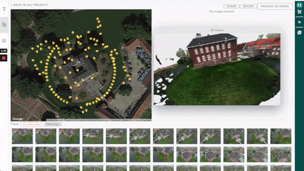
Sharing Your Drone Data Projects in Hammer Missions
Hammer Missions is an adaptive mission planning and data analysis software for drone surveys and inspections. Whatever the mission,...
Apr 19, 20222 min read


Benefits of Using Drones In The Construction Industry
As an industry innovation, drones in the construction industry are really taking off.
Apr 15, 20223 min read


5 BEST DRONES FOR ROOF INSPECTIONS - INFOGRAPHIC
In the past few years, drones have rapidly evolved from being an entertainment device for hobbyists into an essential tool for commercial...
Apr 8, 20221 min read


Tips on Scaling Your UAV Program
Companies of all sizes are considering scaling UAV programs, but putting the right foundations in place to ensure such programs don't fail
Apr 7, 20224 min read


What's New in Hammer Missions - March 2022 Update
In this post, we look at what's new in Hammer Missions' March 2022 product update.
Mar 31, 20221 min read


The Benefits of Using Drones for Inspecting Wind Turbines
By 2025, renewable energy will become the largest source of electricity worldwide, overtaking coal. It is imperative that wind farm...
Mar 29, 20223 min read
bottom of page