top of page


Drone Roof Inspection: The Complete Guide for Commercial Property Managers
Drone roof inspections give commercial property managers faster surveys, better defect detection, and audit-ready records — at a fraction of the cost of traditional methods. Here's everything you need to know.
Jun 17 min read


Capturing Buildings with Drones and AI: Strategies, Tips, and Best Practices
Capturing buildings with drones isn’t just about flying — it’s about delivering structured, high-quality data ready for CAD, BIM, and AI workflows. By dividing your captures strategically, collecting both modelling and inspection datasets, using AI effectively, and standardising operations, you can make your building inspections faster, more accurate, and more valuable over time.
Aug 14, 20253 min read


Drone Operations in Cities: Top 10 Best Practices for London and New York
Explore the top 10 best practices for drone operations in built-up areas like London and New York. Learn essential tips on airspace regulations, flight planning, wind management, GPS challenges, and risk mitigation to ensure safe and successful urban drone missions
Aug 11, 20254 min read


What Drones should you use for Thermal inspections?
Thermal inspections are now a common part of the building inspector's toolkit. Here we look at the market leading thermal kit for drones.
Jul 30, 20243 min read


How to Inspect Tall & Super-Tall Buildings with Drones
Drone inspections aren’t without their challenges especially when the building is hundreds of feet high. Here's a workflow for success.
Apr 22, 20246 min read


Drone Programs: Key Considerations for Drone Building Inspections
New rules are finally allowing drone building inspections in major cities. Here's a quick guide and workflow for urban drone surveys.
Mar 11, 20244 min read


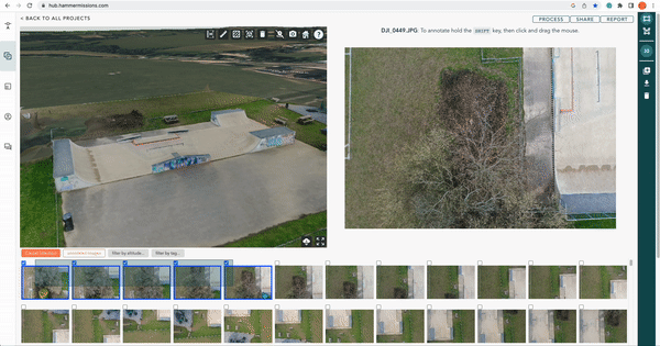
How to tag and filter your data for Drone Inspections?
In this guide, we look at how you tag and filter your images for drone inspections.
Feb 13, 20243 min read


50 Most Common Drone Mapping Terms - Explained.
From GSD, GCPs, Overlap to 3D point clouds and meshes, this post explains the top 50 most commonly used drone mapping terms.
Jan 5, 20248 min read


How to grow your drone mapping & inspection business?
You’ve done your training, and you've got all the kit, how do you get customers for your drone inspection business?
Nov 7, 20238 min read


How to Scan-to-BIM using Drones?
In this step-by-step guide, we look at how to scan-to-BIM using drones, hammer missions and Autodesk suite of tools.
Oct 18, 20233 min read


Types of Stockpile Volume Calculations from Drone Mapping
In this article, we look at the different methods of calculating stockpile measurements from drone mapping for construction earthworks.
Sep 29, 20232 min read


Types of Drone Data Export Formats
We look at the different types of drone data export formats and what they mean for drone mapping - .obj, .fbx, .ply, .las, .tiff and more!
Sep 12, 20235 min read


How to Process Your Thermal Data with Hammer Missions?
In this guide, we go through the steps to process your thermal data in Hammer Missions.
Jul 25, 20232 min read


Drone Roof Inspections: A step-by-step Guide
A comprehensive step-by-step guide on how to conduct roof inspections using drones.
Jul 25, 20235 min read


How to Calibrate the Vision Sensors on the DJI M300 Drone?
How to calibrate the vision sensors on the DJI M300 drone.
Jun 23, 20233 min read


Using the DJI M300 with Hammer Missions
How to use the DJI M300 with Hammer Missions. An end-to-end guide for drone mapping, drone 3D models and inspection.
Jun 19, 20235 min read


How to Price your Drone Services?
In this post, we look at the different approaches to pricing your drone mapping & inspection services - costs, competition and value.
Jun 13, 20234 min read

How to take off your DJI drone?
How to take off your DJI drone using just the remote controller sticks.
Jun 12, 20231 min read


How to Verify Your Drone Data On-Site? | Hammer Missions
In this article, we look at how to use Hammer Missions to verify your drone data before leaving the job site ensuring high-quality data.
Jun 5, 20232 min read

Captured vs Aligned Images in Drone Photogrammetry: What is it and why does it matter?
In this post, we explain the difference between captured vs aligned drone images in drone photogrammetry.
May 24, 20233 min read


The Ultimate Checklist for Drone Mapping | Hammer Missions
In the article, we present the Ultimate Drone Mapping Checklist.
Apr 25, 20235 min read


Using 4D Models in Hammer Missions
In this tutorial, we will be looking at how you implement your drone data projects into a 4D models and timeline.
Mar 30, 20233 min read
![[March 2023] What are the new drone flying rules in the US and UK?](https://static.wixstatic.com/media/b47f1f_3674d2ccdef6460384c8efc1163555ad~mv2.jpeg/v1/fill/w_719,h_461,fp_0.50_0.50,lg_1,q_30,blur_30,enc_avif,quality_auto/b47f1f_3674d2ccdef6460384c8efc1163555ad~mv2.jpeg)
![[March 2023] What are the new drone flying rules in the US and UK?](https://static.wixstatic.com/media/b47f1f_3674d2ccdef6460384c8efc1163555ad~mv2.jpeg/v1/fill/w_719,h_461,fp_0.50_0.50,lg_1,q_90,enc_avif,quality_auto/b47f1f_3674d2ccdef6460384c8efc1163555ad~mv2.jpeg)
[March 2023] What are the new drone flying rules in the US and UK?
In this post, we will be looking at the rules and regulations behind flying drones in both the USA and the UK, as of March 2023.
Mar 29, 20233 min read
Multi-Selection with Hammer Missions
Select multiple photos with ease as opposed to clicking on individual photos one at a time, process partial datasets.
Mar 2, 20232 min read
bottom of page