Capturing Buildings with Drones and AI: Strategies, Tips, and Best Practices
- Hammer Missions

- Aug 14, 2025
- 3 min read
Drones are transforming the way we inspect and capture data from buildings. But beyond the excitement of flying, the real value lies in the data. Whether for architecture, engineering, or construction projects, structured, high-quality drone data can save time, improve accuracy, and streamline workflows, especially when integrated with CAD, BIM, and AI tools.
This guide outlines proven strategies for drone building capture, ensuring your data is accurate, structured, and ready for analysis.
Why Structured Data Matters in Drone Building Capture
While humans can often interpret unstructured data, CAD, BIM, and AI systems require structured inputs to work effectively. The built environment is complex: skyscrapers, cooling towers, bridges, and irregular structures all pose unique challenges. Capturing them well means using techniques that respect the geometry of the structure while ensuring image overlap and coverage.

Strategy 1: Divide and Conquer Your Capture
Short Buildings
For buildings that are shorter than they are long or wide, the ideal approach is:
Top capture (roof images at a consistent altitude)
Orbit capture (drone flights around the perimeter to capture façades)
If the entire façade fits in one image at an oblique gimbal angle, a single orbit can be enough.

Tall Buildings
For taller structures:
Capture the roof.
Capture the façade in vertical strips.
Add a mid-height orbit at an angle to ensure image overlap between roof and façade.

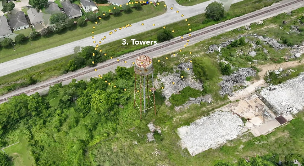
Towers
Fly concentric orbits around the tower.
Keep the gimbal angled down to avoid excessive sky in the images, which can confuse 3D modelling software.

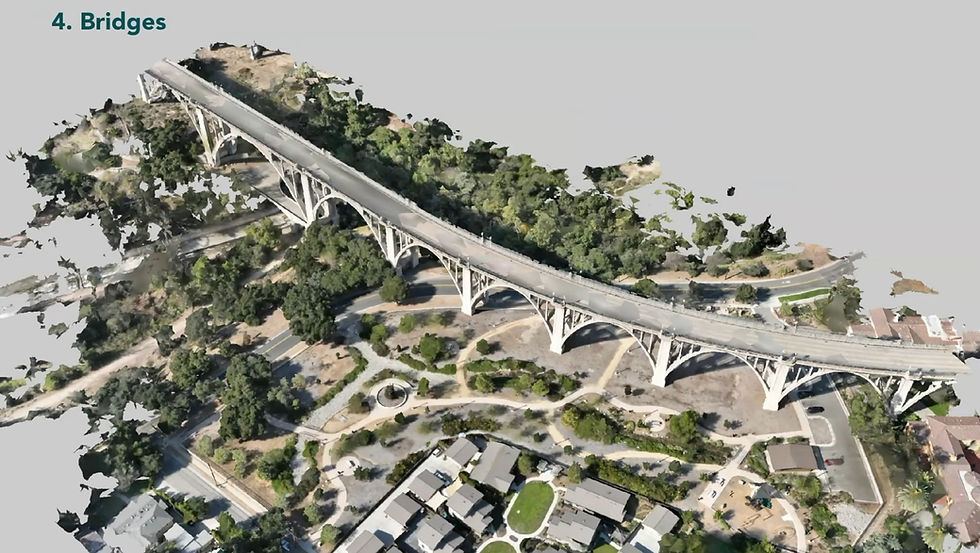
Bridges
Capture the top deck from above.
Capture the underside with side passes.
Ensure overlap between the top and underside datasets for accurate modelling.

Strategy 2: Capture Multiple Data Sets
3D modelling and detailed inspections often have conflicting requirements:
3D modelling:
Images taken from a distance.
Consistent overlap and geometry coverage.
Best handled with automated flight paths.
Inspections:
Close-up images targeting problem areas.
May not require overlap.
Often flown manually.
By collecting two separate datasets, you get the best of both worlds — one for creating the overall model and one for detailed fault analysis.

Using AI to Enhance Drone Inspections
AI can rapidly analyse large datasets, tagging issues like water ponding on roofs. The process:
Create your 3D model from overview images.
Add inspection images for detail.
Use AI to automatically identify and mark defects.
Manually review and confirm AI findings, improving its accuracy over time.
Over multiple inspections, the AI learns from human feedback, becoming faster and more accurate than manual review alone.

Strategy 3: Standardise Your Drone Operations
To achieve consistent, scalable results:
Develop a standard workflow from capture → verification → processing → visualisation → sharing.
Apply the same workflow to all projects, adjusting only the applications needed (e.g., asset inspection, site mapping, measurement, AI reporting).
Standardisation ensures you can scale operations without sacrificing quality or simplicity.
Summary
Capturing buildings with drones isn’t just about flying — it’s about delivering structured, high-quality data ready for CAD, BIM, and AI workflows. By dividing your captures strategically, collecting both modelling and inspection datasets, using AI effectively, and standardising operations, you can make your building inspections faster, more accurate, and more valuable over time.
About Us
Hammer Missions is a software AI firm helping companies in the built environment leverage drones and AI for assessing existing conditions. Having seen 5000+ projects, we're pleased to be working with leading firms in AEC to streamline and scale the process of facade inspections. If you're looking to learn more about how AI can automate and accelerate your building assessment projects, please get in touch with us below. We look forward to hearing from you.
Looking to improve your drone inspections? Get in touch with us below


