top of page


2D Drone Maps (Orthophotos) on Hammer Missions
In this short guide, we will take you through the steps to create a 2D map (orthophoto / orthomosaic) with Hammer Missions.
Feb 10, 20232 min read
What is 4D Drone Mapping and how does it work? | Hammer Missions
In this article, we look at what is 4D Drone data and how drone outputs such as maps and 3D models over time can help build a 4D job site.
Feb 7, 20234 min read


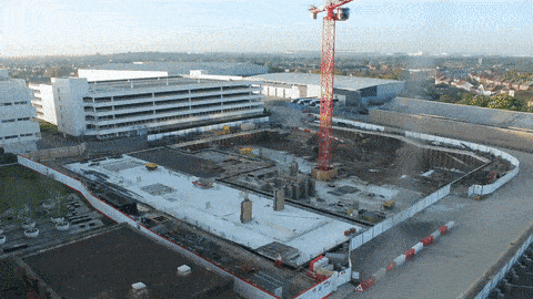
Accuracy of Stockpile Volumes from Drone images | Hammer Missions
In this study, we look at how accurate are the stockpile volume calculations from drone images, 3D models and hammer missions.
Jan 27, 20233 min read


Safety In Vertical Drone Flights | Hammer Missions
Vertical drone flights can be a nerve-wracking experience but if done correctly with all safety aspects and mitigation taken into account.
Jan 12, 20233 min read


How Do Drones & Digital Twins Power the Golden Thread of Information?
In this article, we will look at how do drones and digital twins power the golden thread of information in AEC.
Dec 22, 20225 min read


Accuracy of Measurements in Drone 3D Models | Hammer Missions
In this article, we understand the accuracy of 3D measurements using drone 3D models when compared to real world measurements.
Dec 21, 20222 min read


What is the Golden Thread and why does it matter in AEC?
An explanation of the golden thread of information and its importance in AEC, using digital twins & drones.
Dec 9, 20225 min read


Drones In Construction | Hammer Missions Podcast
A podcast covering drones in construction, including everything from digital twins & measurements to integrations and stakeholder alignment
Nov 26, 20223 min read


Drone Mapping vs Drone Inspections | What's The Difference Anyway?
Drone Mapping vs Drone Inspection - What's the difference and when to use which? We answer the question in this post.
Nov 14, 20224 min read


Why Drones Are a Game Changer for Facade Inspections
Drones are revolutionizing facade inspections in AEC. Here we look at the biggest benefits.
Nov 6, 20225 min read


GCPs vs RTK vs PPK - What is best?
GCPs, RTK or PPK - which method is the best for accurate drone mapping and 3D models? We explore the pros and cons in this post.
Nov 4, 20223 min read


Enterprise Drone Programs: How to Measure ROI?
Measuring the ROI of an enterprise drone program can be challenging for a business. Here are some tips.
Oct 27, 20226 min read


Improving the Quality of your Drone Maps and 3D Models
In this post, we explore how you can greatly improve the quality of your drone maps and 3D models by focusing on key data capture workflows.
Oct 24, 20226 min read


The Role of Drones & Digital Twins in Engineering & Construction
Drones & Digital Twins are the most powerful thing to come to the AEC industries in decades.
Oct 19, 20226 min read


The New DJI Mavic 3 Enterprise Drones
We review the DJI Mavic 3 Enterprise drone including both the Enterprise (DJI Mavic 3E) and Thermal (DJI Mavic 3T) released by DJI.
Oct 9, 20223 min read


Drone Programs: Top 5 Considerations
Starting Enterprise Drone Programs can be challenging. In this article, we look at the top 5 considerations for starting UAS programs.
Sep 27, 20225 min read


Drone PPK - How does it work?
In this article, we look at how drone PPK works and how Hammer Missions can be used to create RINEX files for drone PPK workflows.
Sep 22, 20224 min read


Camera Specs & Megapixels - Do they matter for Drone Photogrammetry?
A case study on drone camera megapixels and their impact on drone mapping and photogrammetry. Three 3D models were captured and processed.
Aug 30, 20228 min read


Drone Photogrammetry Software: How does it work under the hood?
Drone Mapping & Photogrammetry has become a common place. This guide looks at the steps involved in mapping and photogrammetry.
Aug 23, 20224 min read


Best Drone Apps And How To Use Them
In this short article, we will discuss some of the best drone apps on the market, their purpose, and how to use them in your workflows.
Jul 22, 20224 min read


Flight Planning For Unlocking DJI Drones In No Fly Zones
In this guide, we will establish how to unlock DJI Drones to enable flight planning in pre-defined Geo-restricted zones, using DJI Flysafe.
Jul 19, 20225 min read


What are Flight Lines and Tie Lines in Magnetic Drone Surveys
Picture courtesy of SkyFront Overview In this article, we will discuss flight lines and tie lines and how they are relevant in drone...
Jul 9, 20222 min read


Desktop vs Cloud Drone Software
In this article, we will look at the key considerations to bear in mind while choosing between desktop vs cloud drone software.
Jul 8, 20224 min read


A Guide to Drone Photogrammetry
In this guide, we will explain the process and how you would achieve the 3D Output whilst maintaining the highest quality data collection.
Jun 14, 20224 min read
bottom of page