Customer Case Study — RDH Building Science
35,000+ sq ft of deficiencies found on one landmark hospital
How RDH Building Science inspected a 19-storey, 1.2M+ sq ft historic hospital with drones and Hammer Missions’ AI — no scaffolding, no rope access, and weeks of manual review compressed into a fraction of the time.
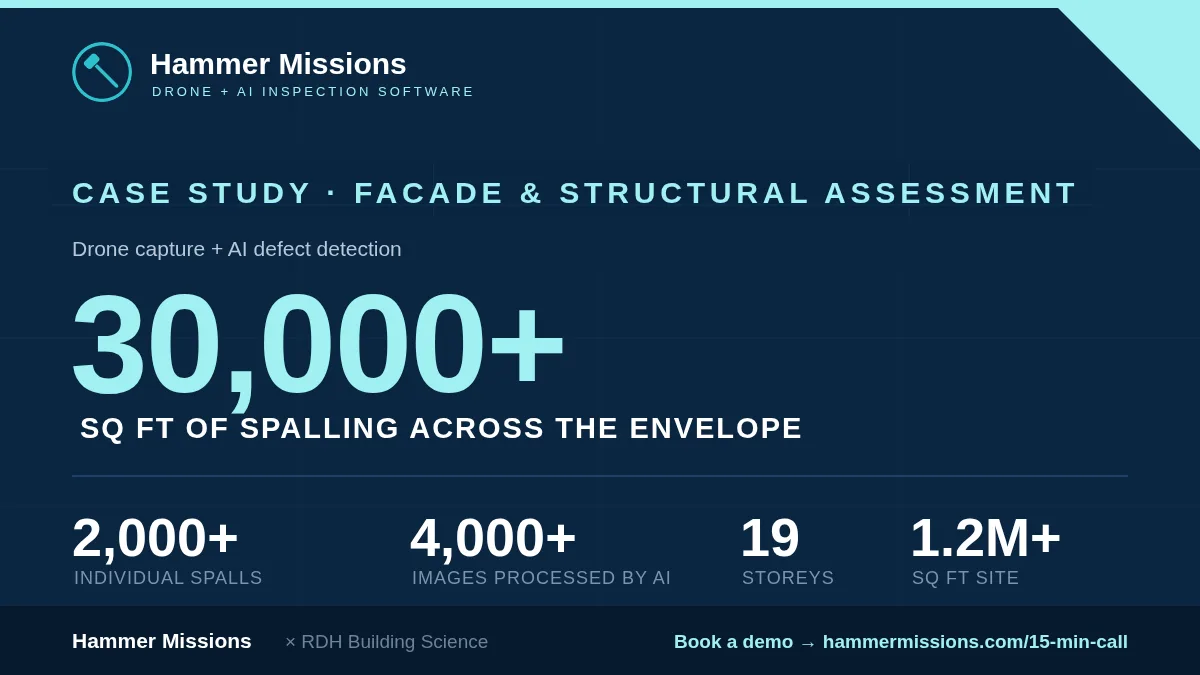
Storey landmark hospital, opened in the 1930s
Square feet of site captured without rope access
Images processed into a high-resolution digital twin
Individual spalls detected and engineer-verified
Square feet of spalling quantified
Square feet of cracking mapped to the 3D model
The challenge: a landmark building at scale
The hospital is a 19-storey landmark that first opened in the 1930s, part of a site spanning more than 1.2 million square feet. A traditional facade and structural assessment would mean rope-access drops and hands-on inspection across the full envelope — slow, cost-prohibitive and disruptive at this scale, with defects easily missed or recorded inconsistently.
The inspection was led by senior forensic engineer Clay Harman of RDH Building Science. Drones and AI solved the access problem by bringing the entire envelope to the desktop — but capturing a building this size comprehensively meant collecting over 4,000 images, far more than any team could realistically review defect by defect. That volume is exactly where a purpose-built platform becomes essential.
01
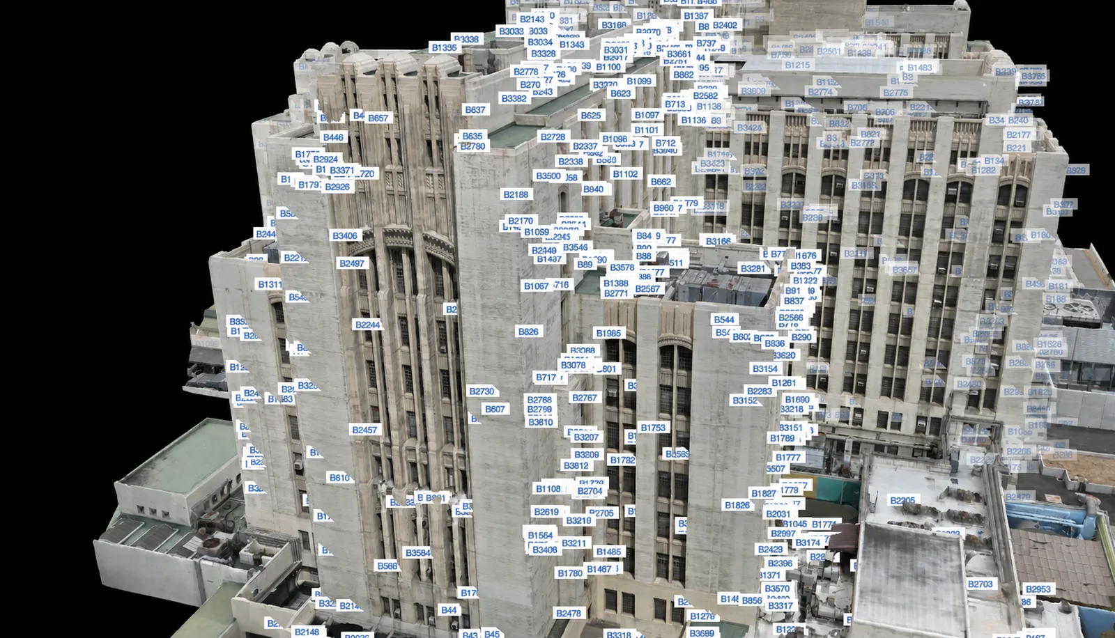
Automated flight planning for complete coverage
RDH designed waypoint missions around the full envelope — top-down passes for the roofs, angled passes for facade detail, and vertical overlap between the two. That disciplined, repeatable flight design is what makes gap-free reconstruction achievable on a footprint this size, accounting for tight angles, obstructions and the places defects like to hide.
02
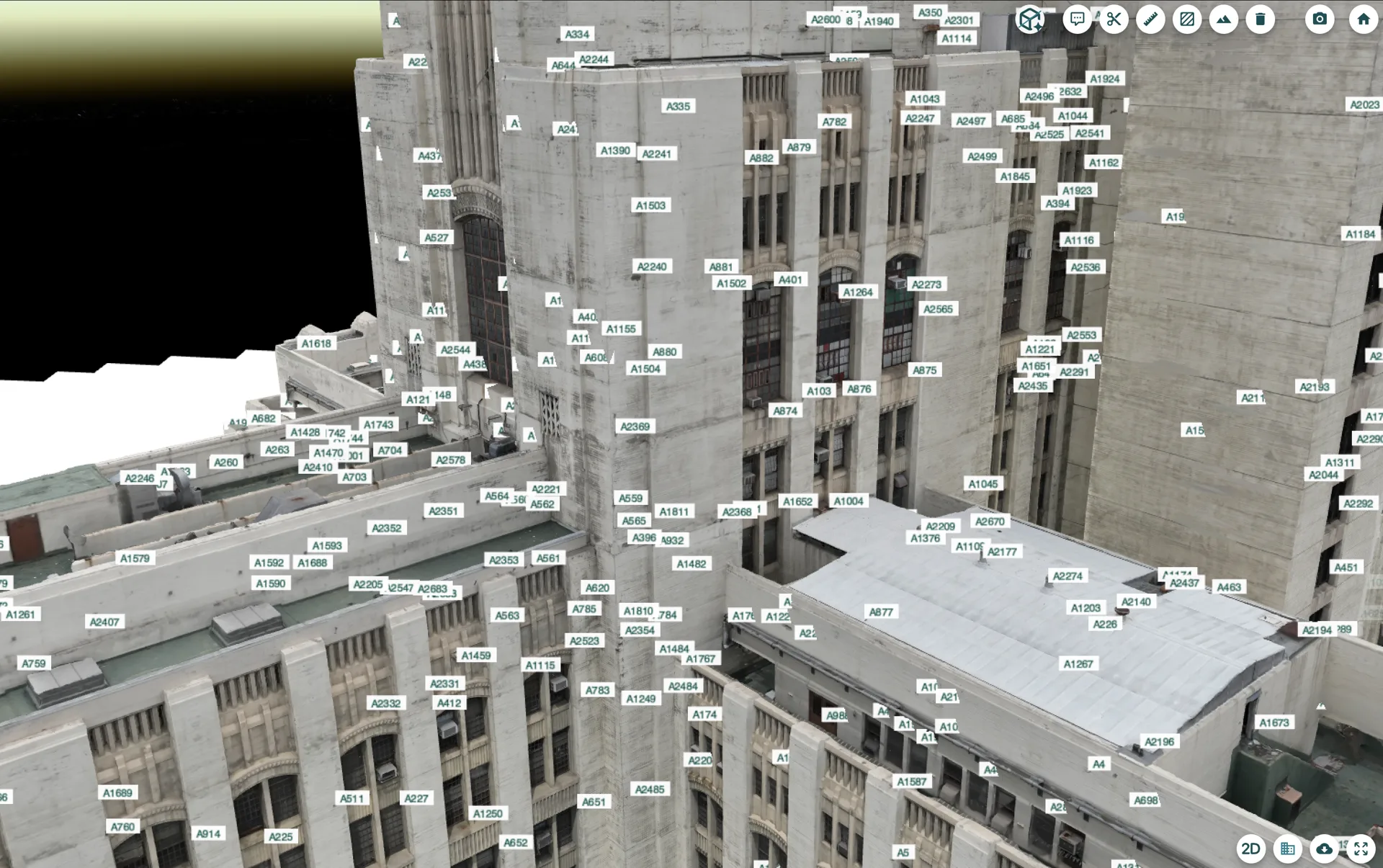
From 4,154 images to a digital twin
The captured imagery was uploaded to Hammer Hub and processed into 2D maps and a detailed 3D model — a digital twin of the hospital the team could explore in full from the desktop, instead of hanging off the side of the building.
03
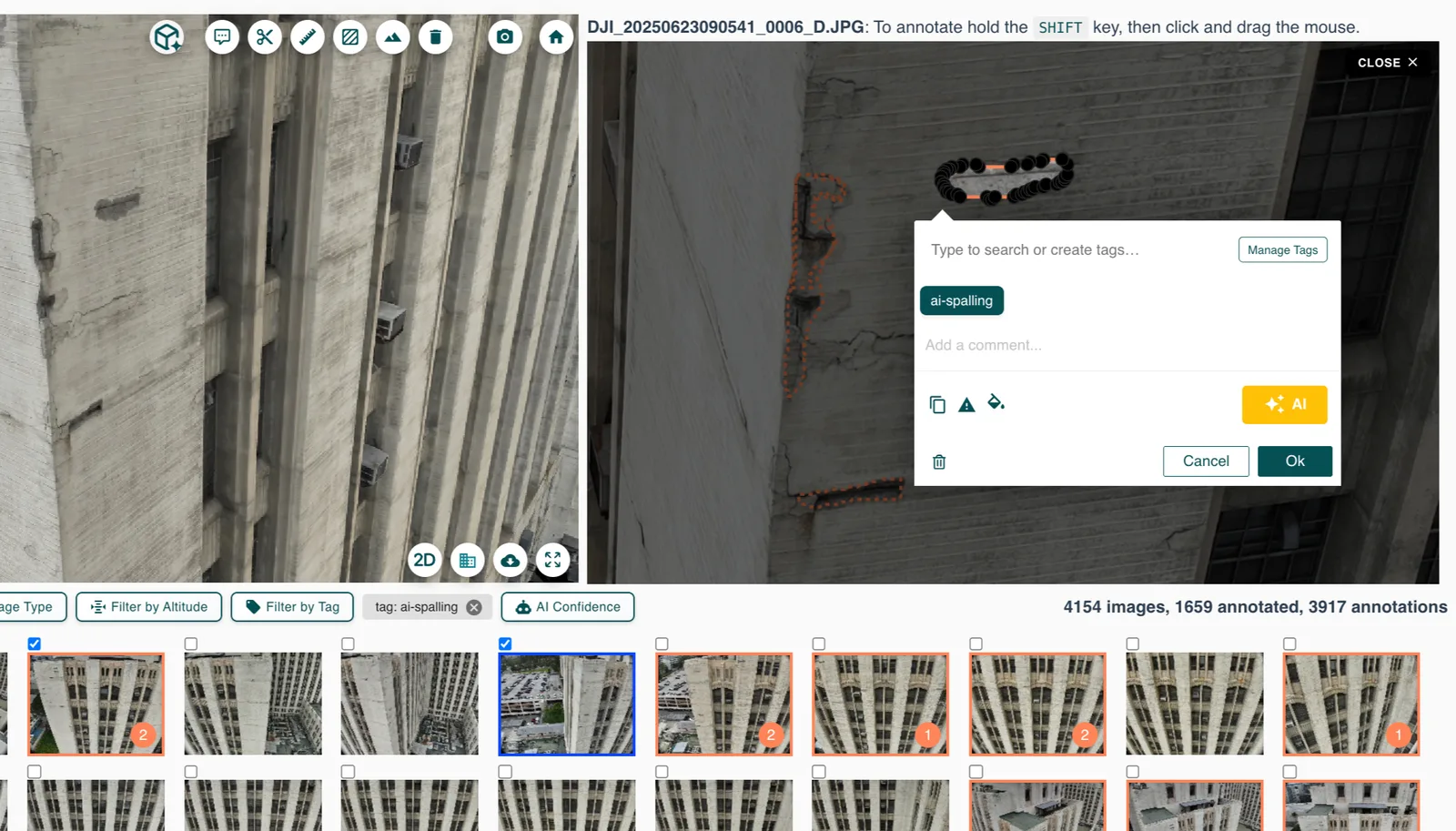
AI defect detection across the full envelope
Hammer Missions' AI automatically identified and tagged cracks and spalls across every image, surfacing candidate defects wherever they appeared — including the subtle ones that are easy to miss when reviewing thousands of photos by eye.
04
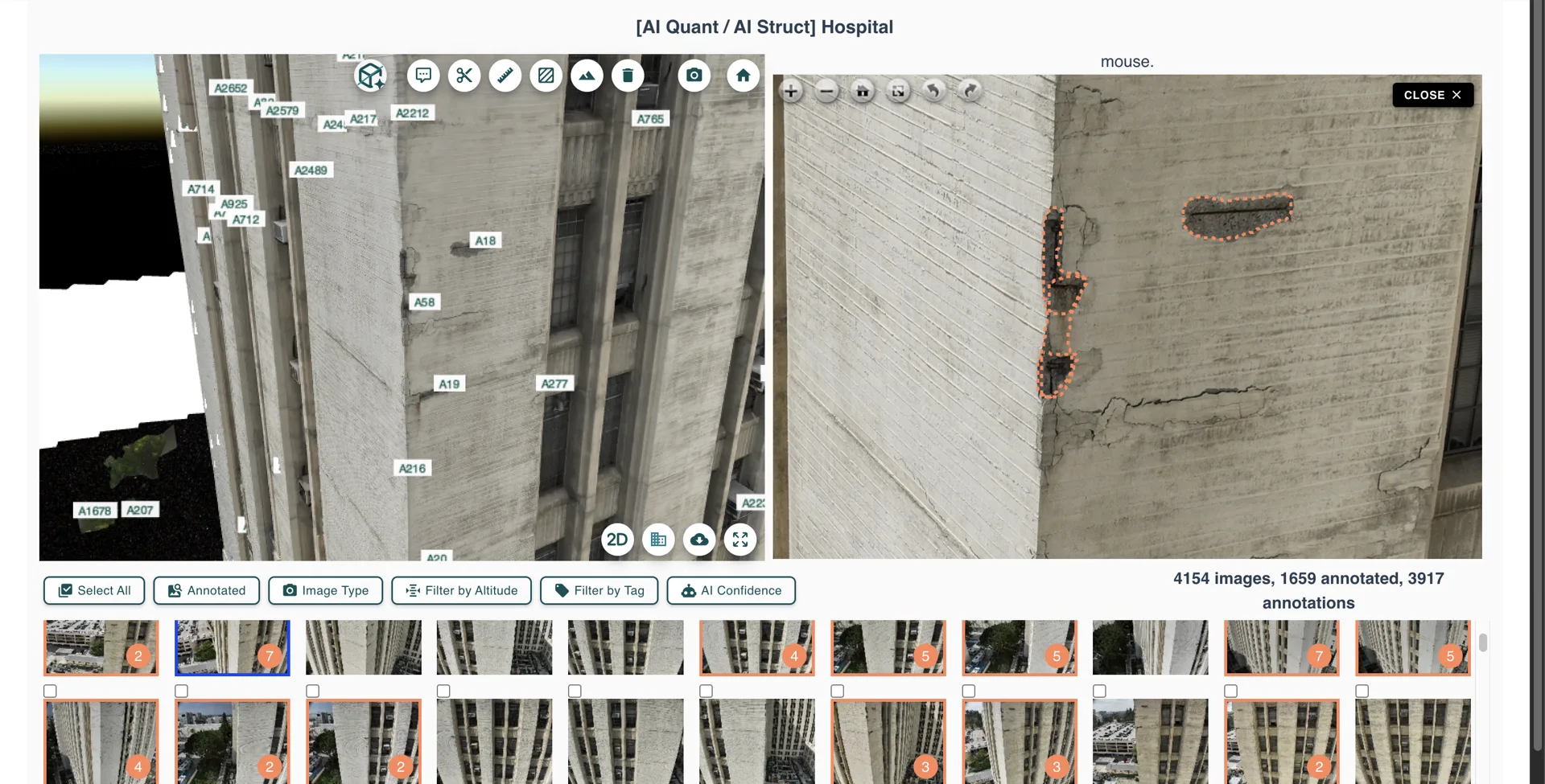
Engineer verification, quantification and reporting
RDH's engineers cross-verified every flagged defect against the source imagery and the 3D model, assigning severity and measuring affected area in-model. The result: a quantified, location-anchored inventory exportable to PDF and CSV, plus a shareable interactive model the client can explore themselves.
“Manually documenting and quantifying the facade deficiencies would’ve been nearly impossible without Hammer Missions. These tools, combined with engineering principles and careful review, have provided a baseline for saving and repurposing this landmark building.”
Clay Harman — Associate, Senior Engineer, RDH Building Science Inc.
The outcome
RDH captured a 19-storey, 1.2M+ sq ft landmark safely and non-intrusively, processed 4,000+ images without weeks of manual review, and converted the data into a quantified, location-anchored inventory of 2,000+ spalls across 30,000+ square feet — complete with severity ratings and a shareable, interactive model.
For owners, that’s a defensible, prioritised basis for repair budgets and capital planning. For engineering firms, it means catching defects at a scale and consistency manual methods can’t match — and delivering results clients can navigate themselves.
Get Started