Customer Case Study — High-Rise Building Inspection
Inspecting a 10+ storey high-rise without scaffolding or rope access
How a real-world high-rise assessment used drones, 3D modeling, and Hammer Missions’ AI to find water stains and spalling across the full envelope — faster, safer, and more affordable than traditional access methods.
Storey building inspected without scaffolding or rope access
Images captured around the full envelope from predefined waypoints
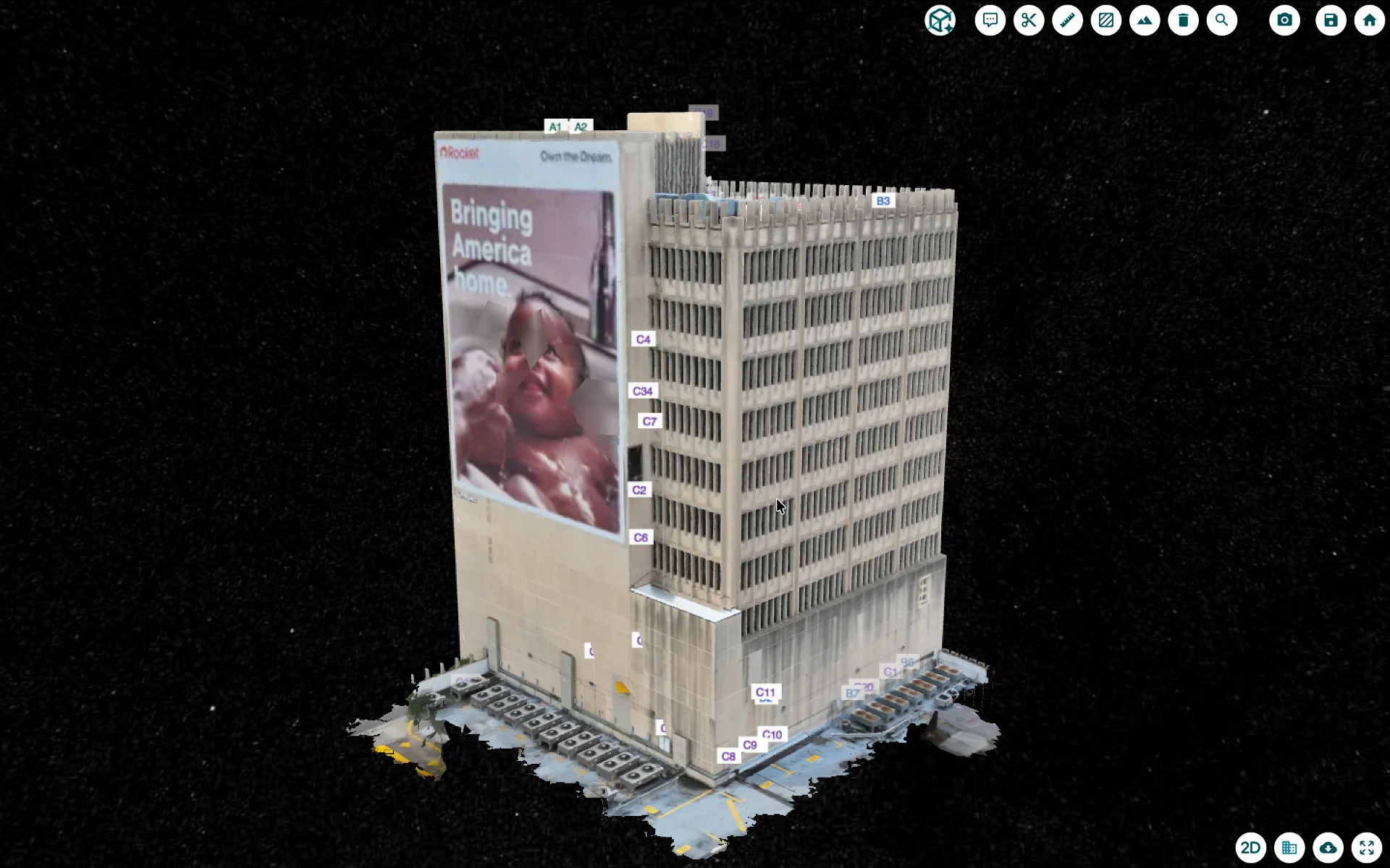
To process the imagery into a 2D map and detailed 3D model
Detected and tagged water stains and spalls across every image
Annotations found with AI and confirmed during manual review by the engineer
With interactive links straight into the 3D model
The challenge: safe access to every storey
On a building exceeding ten storeys, gaining safe and comprehensive access to every part of the structure is the biggest hurdle. Traditional methods are costly, risky, and prone to human error — and defects recorded from a swing stage or rope drop are easy to miss or capture inconsistently.
Drones removed the access problem by bringing the entire building to the desktop. Engineers could assess the roof and every facade from the ground — faster to deploy, safer for the people doing the work, and dramatically cheaper for the client. But capturing a building this size comprehensively meant collecting thousands of images, far more than any team could realistically review defect by defect. That volume is exactly where a purpose-built platform becomes essential.
01
Flight planning for complete coverage
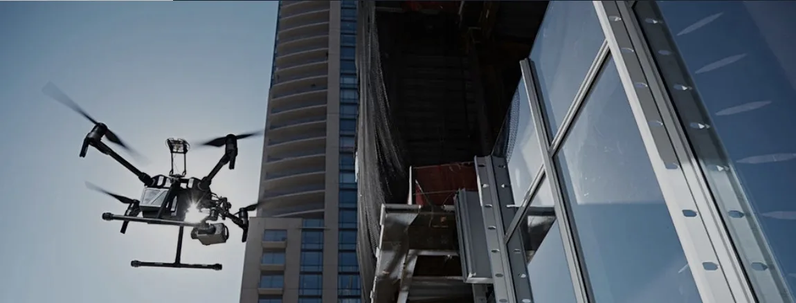
The drone followed predefined waypoints around the full envelope — top-down passes for the roof, angled passes for facade detail, and vertical overlap between the two so no gaps were left in the reconstruction. Because those flights are repeatable, the same coverage can be captured again and again — keeping people off the building and turning a costly access operation into days of flight time.
02
From thousands of images to a digital twin
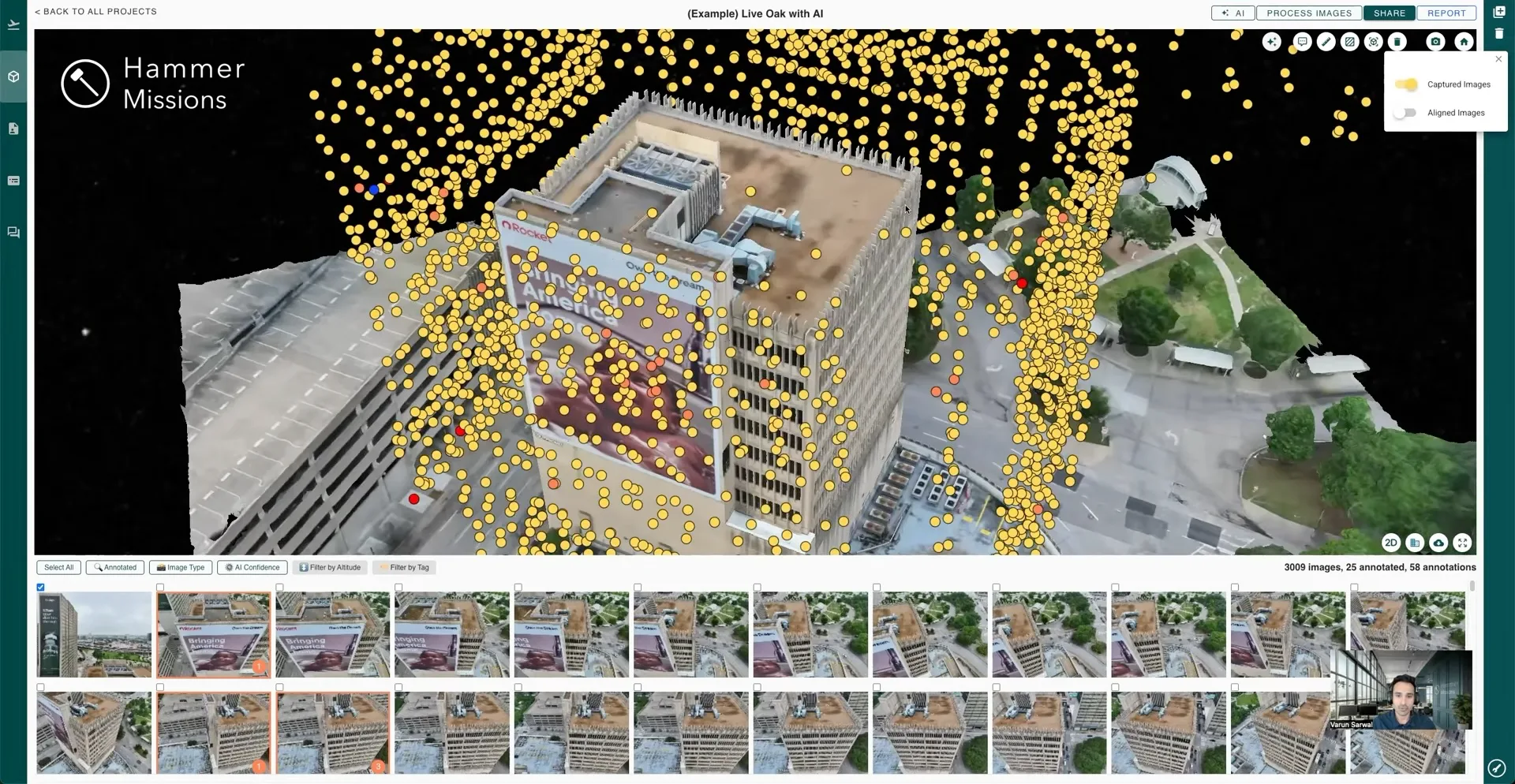
The more than 3,000 captured images were processed in over 12 hours into 2D maps and a detailed 3D model — a digital twin of the building the team could explore in full from the desktop. Instead of assessing condition from a swing stage, engineers zoomed, rotated, and inspected the entire envelope from anywhere.
03
Defects spotted on the model and in the imagery
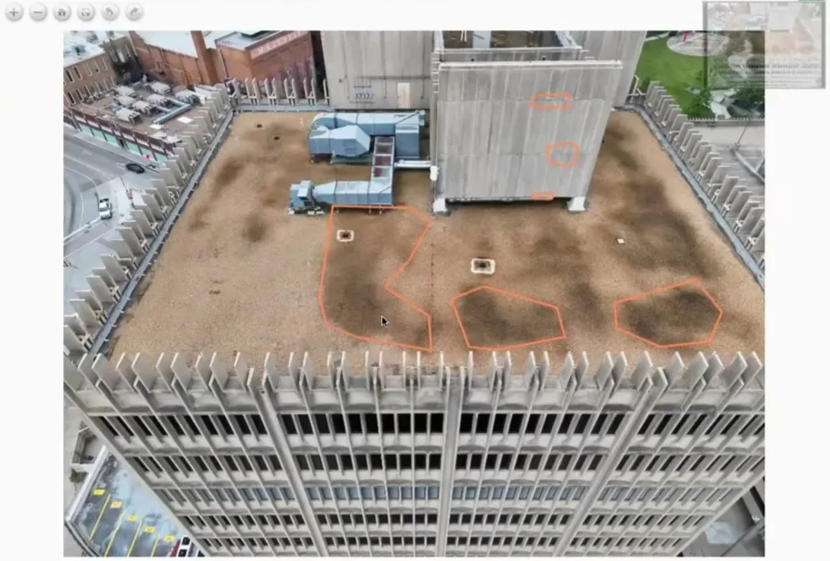
Water staining on the roof and facade was visible directly on the model, hinting at possible water ingress or drainage issues. Smaller but critical defects like spalling were found by clicking any part of the model to bring up the closest high-resolution drone image. Each finding was tagged to its precise 3D location — so similar-looking areas stay distinguishable and the record stays organized.
04
AI detection, engineer verification
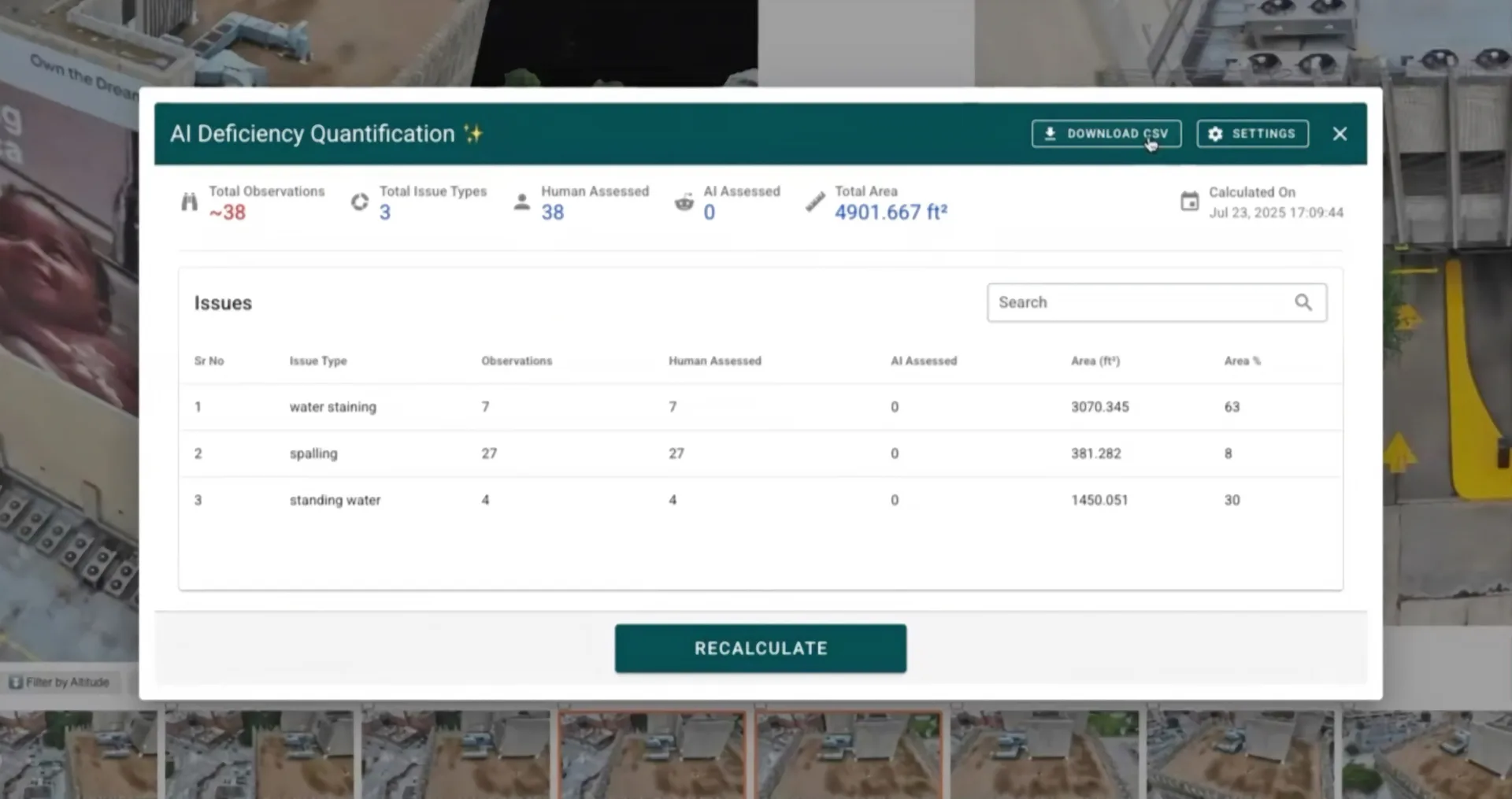
To make sure nothing was missed, AI models automatically detected and tagged water stains and spalls across every one of those images — catching subtle defects that are easy to overlook in manual review. That saved the team weeks of review time, but the findings are assistance rather than replacement: every AI-flagged defect was reviewed and verified by an engineer before it entered the record. The result was 277 annotations, each found with AI and confirmed during manual review, and each tagged to its precise 3D location.
“By combining human expertise with AI technology, the inspection team was able to generate a more complete and reliable defect inventory, improving confidence in the assessment results.”
The outcome
The team captured the full envelope safely and non-intrusively, and turned 3,000+ images into a quantified, location-anchored inventory of 277 defects — every water stain and spall found with AI and confirmed during manual review, measured in square feet or square meters, and rated by severity so high-priority repairs surface first.
For owners, that’s a defensible, prioritized basis for repair budgets and capital planning. For contractors, it means precise defect locations and severity ratings for targeted repairs and better resource allocation. And because the report links straight into the interactive 3D model, clients and stakeholders can explore the findings themselves — no site visit required.
Interested in learning more about this project?
Get Started