Customer Case Study — Facade Inspection, Florida
From storm damage to quantified defects: a full facade inspection of a seaside condominium
How an end-to-end facade inspection of Admiralty Point used drones, 3D modeling, and Hammer Missions’ AI to document existing conditions and quantify defects — faster, safer, and more affordable than traditional access methods.
Of the facade captured from the air — no scaffolding, swing stages, or rope access
High-resolution, overlapping images covering the roof and every facade
Map and navigable model processed from the imagery, reviewable from a desktop
Every defect recorded with its location and supporting imagery
Detected, classified, and quantified defects by type and affected area
Report with annotated imagery and links into the live 3D model
The challenge: prove the condition, document the defects
In a storm-prone region like Florida, building owners face two pressing needs: proving that damage was caused by a storm rather than a pre-existing condition, and preparing for milestone inspections that require the building’s condition to be documented quickly, safely, and cost-effectively.
Traditional facade inspections make both difficult. Access is costly and risky, defects recorded from scaffolding or rope drops are easy to miss or capture inconsistently, and the resulting documentation is rarely precise enough to stand up in an insurance claim. Drones removed the access problem entirely — but a building this size produces hundreds of images, far more than any team could review defect by defect. That volume is exactly where a purpose-built platform becomes essential.
01
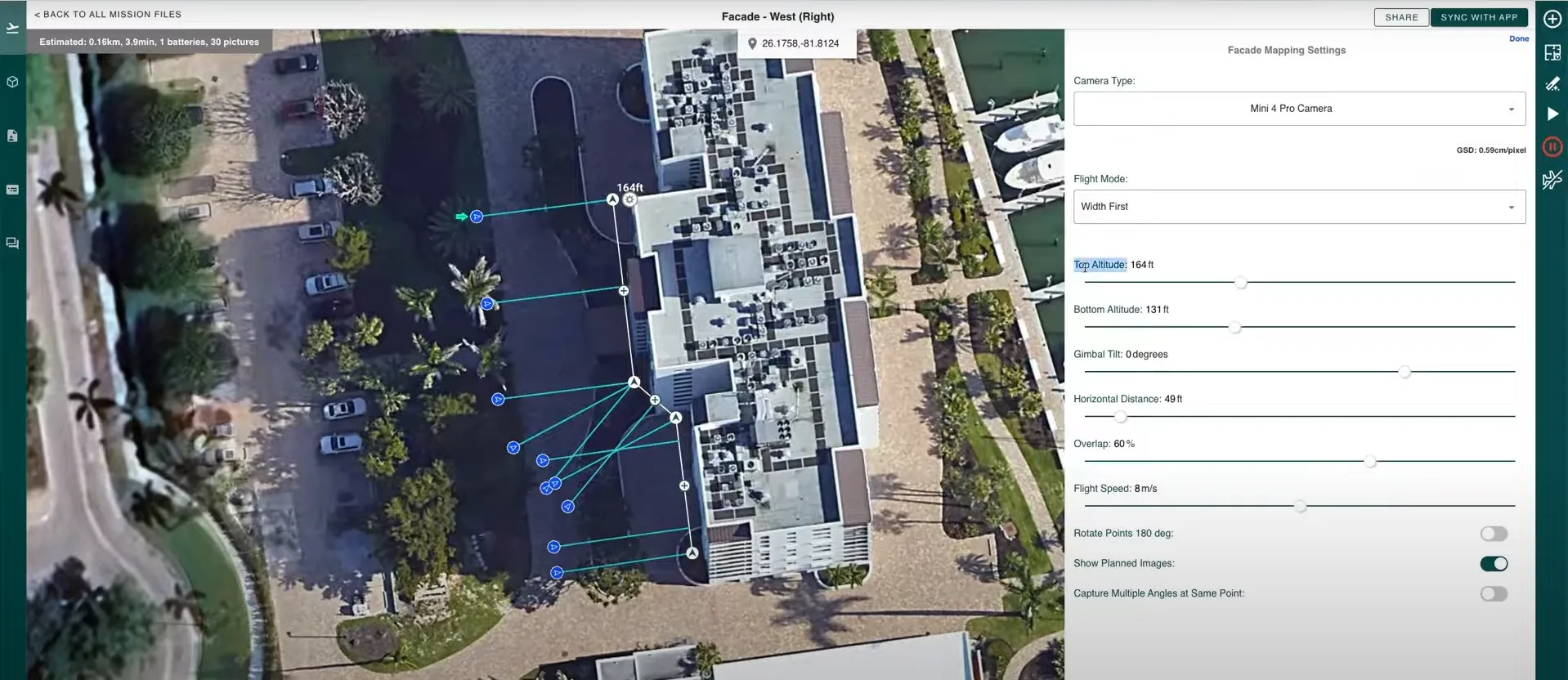
Flight planning for complete facade coverage
The building's facades were defined directly on a digital map, with an automated flight path capturing every square inch of the surface — including hard-to-reach crevices and overhangs. Altitude, overlap, and gimbal angle were tuned so the imagery would be sharp enough for structural and material analysis. And because the plan is repeatable, the same coverage can be recaptured season after season — keeping people off the building and turning a costly access operation into hours of flight time.
02
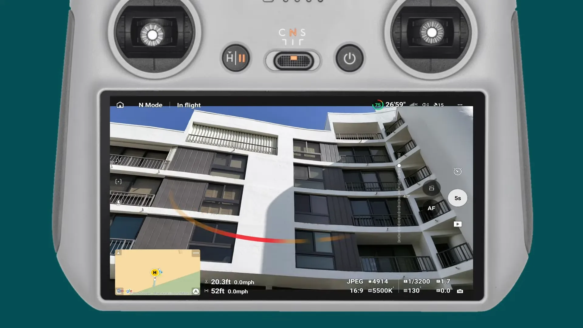
On-site capture, adapted to the building
With the mission synced to the drone controller, the capture team flew the site, adjusting in real time for the features every building presents — recessed balconies, protrusions, reflective glass, and narrow niches. The result: hundreds of high-resolution, overlapping images covering the roof and all facades, captured safely from the air. No scaffolding was erected and nobody worked at height.
03
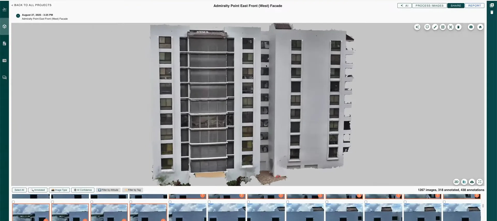
From raw imagery to a navigable 3D model
Back in the office, the imagery was processed automatically into a 2D map and a 3D model of the building. Instead of sorting through thousands of raw photos, engineers reviewed the structure in facade mode — virtually flying along each building face, zooming in, and inspecting every part of the envelope from a desktop. Defects such as cracked stucco, paint delamination, corroded metalwork, and window frame coating failures were tagged directly on the model, each geotagged with supporting imagery.
04
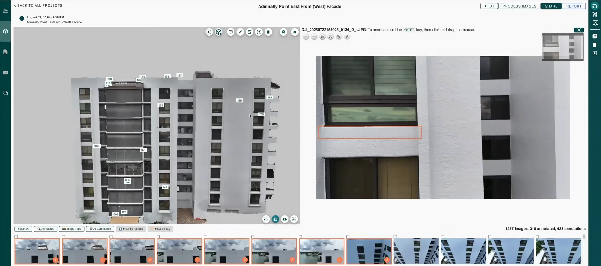
AI detection and quantification, verified by engineers
AI models trained on previously annotated projects then scanned the imagery automatically, detecting and classifying cracks, corrosion, and damaged coatings — catching issues that are easy to overlook in manual review and keeping findings consistent across large portfolios. Beyond finding defects, the software quantified them, calculating the surface area affected by each type of damage. Every AI finding was reviewed by an engineer before it entered the record, so the final inventory is both fast to produce and defensible.
“Drone-based inspections are no longer experimental — they’re becoming the new standard for maintaining safety, compliance, and resilience in our built environment.”
The outcome
The team captured the full envelope safely from the air and turned hundreds of images into a quantified, location-anchored defect inventory — every cracked stucco patch, corroded shutter box, and coating failure counted, measured by area, and recorded with its supporting imagery.
For owners, that means a dated, defensible record of existing conditions that stands up in insurance claims after a storm — and a precise scope for repair costing. For engineers, it means richer data with hours of manual review saved. And because the report links straight into the live 3D model, insurers, contractors, and regulators can open and explore the findings themselves — no site visit, no software installation.
Interested in learning more about this project?
Get Started