top of page


LIDAR vs Photogrammetry: What’s the Difference?
Learn the key differences with LIDAR vs photogrammetry for drone mapping and inspections. Discover how each technology works, their real-world applications, and when to use one over the other for the best results.
Nov 10, 20254 min read


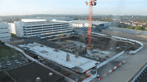
Optimising Drone 3D Mapping: Which Flight Plans Deliver the Best Results?
Learn how different flight plans impact drone 3D mapping quality. Compare single grid, double grid, facade mapping and combined missions for best results.
Oct 28, 20254 min read


How Accurate is Drone Data?
Learn the difference between relative and absolute accuracy in drone inspections, why GSD matters, and how to get reliable data for engineering projects.
Sep 16, 20254 min read


Drone Operations in Cities: Top 10 Best Practices for London and New York
Explore the top 10 best practices for drone operations in built-up areas like London and New York. Learn essential tips on airspace regulations, flight planning, wind management, GPS challenges, and risk mitigation to ensure safe and successful urban drone missions
Aug 11, 20254 min read

What is Vertical Overlap in Drone Mapping & Inspection?
In this article we'll help you understand vertical overlap and why it's essential for accurate drone mapping and inspections. We will break down what vertical overlap is, why it matters for building facades and complex 3D models, and how you can optimise your drone missions for the best results. Whether you're flying manually or using automated tools like Hammer Missions, mastering overlap will transform your inspection accuracy.
Jul 10, 20253 min read


The Risks & Rewards of AI in Construction
Are construction jobs at risk from robots? Here we look at the risks and rewards of AI in Construction.
Nov 20, 20235 min read


What's New in Hammer Missions | May 2023 Product Update
What's New in Hammer Missions May 2023 Update.
Jun 6, 20232 min read

Captured vs Aligned Images in Drone Photogrammetry: What is it and why does it matter?
In this post, we explain the difference between captured vs aligned drone images in drone photogrammetry.
May 24, 20233 min read


The 6 Types of Drone Data | Hammer Missions
In this post, we explain the 6 types of drone data - everything from raw data all the way to 3D models and actionable PDF reports.
May 5, 20233 min read

What's New in Hammer Missions | April 2023 Product Update
What's new in Hammer Missions, Apr 2023 - Hammer Hub, Smart Controller App, Data Verification, 3D Data Processing and More.
May 4, 20232 min read


The Ultimate Checklist for Drone Mapping | Hammer Missions
In the article, we present the Ultimate Drone Mapping Checklist.
Apr 25, 20235 min read


The Power of 4D Drone Mapping in Construction
The power of 4D Drone Mapping, digital twins and 4D reporting in the construction industry.
Apr 18, 20234 min read


Using 4D Models in Hammer Missions
In this tutorial, we will be looking at how you implement your drone data projects into a 4D models and timeline.
Mar 30, 20233 min read


What are Ground Control Points? Drone Mapping | Hammer Missions
We look at what are GCPs (ground control points), their importance for accuracy of drone mapping and compare them with RTK/PPK methods.
Mar 21, 20234 min read


What is a Digital Twin? | Hammer Missions
In this article, we explore what are digital twins, their importance and how drones, mapping and 4D models are enabling digital twins in AEC
Mar 16, 20233 min read


DJI M30 vs DJI M30T | What's the difference?
In this post, we will look at comparisons between the M30 and M30T, what the difference is, and the use cases for both drones.
Mar 14, 20233 min read


DJI Mavic 3T Cameras Explained
We look at the DJI M3T cameras, their specs and use-cases and how to use them for end-to-end drone inspections, both visual and thermal.
Mar 2, 20233 min read

The Importance of Oblique Images in 3D Drone Mapping
In this post, we look at nadir + oblique images and why using them together is very important to create the best drone 3D Models possible.
Feb 24, 20233 min read

2D Drone Maps (Orthophotos) on Hammer Missions
In this short guide, we will take you through the steps to create a 2D map (orthophoto / orthomosaic) with Hammer Missions.
Feb 10, 20232 min read
What is 4D Drone Mapping and how does it work? | Hammer Missions
In this article, we look at what is 4D Drone data and how drone outputs such as maps and 3D models over time can help build a 4D job site.
Feb 7, 20234 min read
bottom of page