EXPLAINED: Ground Sampling Distance (GSD) in Drone Mapping
- Hammer Missions

- Mar 2, 2024
- 3 min read
In this article, we delve into a fundamental concept in drone operations - GSD, or Ground Sampling Distance. You might have heard about GSD before, but stick around because we're going to explore its depth and importance beyond the surface level.
If you’d rather watch than read, Varun from Hammer Missions takes you through more detail in ‘GSD and its Importance in Drone Mapping & Inspection Applications’. Click to watch below:
What is GSD?
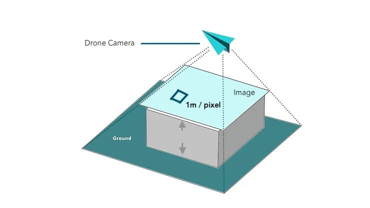
Let's start with the basics. GSD refers to the amount of ground or surface area your drone camera covers during flight. Every image captured by the drone consists of pixels, and the size of each pixel represents the GSD. While it's called ground sampling distance, it's essential to note that it applies to any surface being mapped, not just the ground itself.
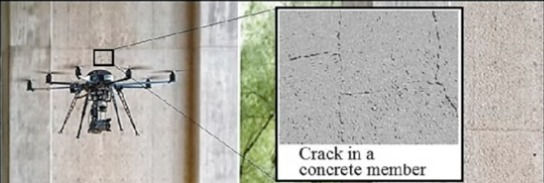
Ground Sampling Distance doesn’t apply to just ‘ground’. Whether you’re capturing the data vertically for a facade inspection or from above for a roof inspection, the GSD applies to the surface, not necessarily the ground.
NB: GSD depends on the surface being mapped or inspected, as opposed to the 'Ground'

Resolution and Efficiency
Contrary to intuition, a lower GSD actually results in higher-resolution data. This means more detail is captured in each image. However, striving for the lowest GSD isn't always ideal! Balancing data quality, safety, and efficiency is crucial in drone operations. Flying closer to the ground might improve resolution but could compromise safety and efficiency. As always, finding the right balance is key.

Impact of GSD on Data Accuracy
GSD significantly affects drone data accuracy, including both relative and absolute accuracy of measurements. Whether you're measuring stockpiles or ensuring geo-referencing accuracy, the GSD used during data capture plays a vital role. Understanding these constraints is essential for accurate results in drone mapping and modeling tasks.
Why does GSD affect accuracy? The simplest way to understand that is to think about GSD as a quality metric for your dataset. Lower the GSD, higher the quality will be. A higher quality dataset will ensure that everything in the scene has been modelled correctly, leading to more accurate measurements when compared to the real world.
Curious to learn how GSD can affect measurements? Learn more with our case study here.

Motion Blur Considerations
Motion blur, a common occurrence in drone flights, can degrade image quality. It's crucial to minimize motion blur by ensuring that it doesn't exceed twice the GSD. Failing to do so can result in compromised data quality and inaccuracies in the final output. To be on the safe side, we recommend that your motion blur is no more than 1x GSD of your project.
But how you do you ensure that motion is kept to minimum in your mapping projects?
GSD: Mapping vs. Inspection
The implications of GSD vary depending on the application. In mapping scenarios, it aligns with data accuracy requirements. However, in inspections, Ground Sampling Distance determines the visibility of defects or anomalies in the output images. Understanding these differences is vital for achieving the desired outcomes in diverse drone missions.
For instance, if you goal is inspection of a built structure, GSD can be used to determine how big or small will the defect look in the captured drone images.

Calculating GSD
To find out more about calculating Ground Sampling Distances for drone missions check out our guide on calculating GSD.
Conclusion
Ground Sampling Distance is more than just a technical term in drone operations. It's a critical factor that influences data quality, accuracy, and the overall success of missions. By grasping its significance and implications, drone professionals can optimize their workflows and contribute to advancing the industry's standards.
Alternatively, here's a free spreadsheet that will help you calculate GSD for your flights.
Subscribe to our YouTube channel for more insights into the world of drone mapping and inspection!
About Hammer Missions
Hammer Missions provides survey-grade drone software solutions to help streamline drone inspections, site surveys, 3D mapping and asset monitoring projects.
Sign up for our free trial (no credit card required) or arrange a demo with one of our drone inspection specialists.

